
07 3396 9988
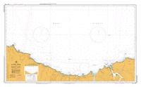
Stony Head to Rocky Cape
SKU:
AUS799 Category:
$0.00
Description:
AUS CHART 799 - Stony Head to Rocky Cape
Chart Number Aus799
Title Australia - Tasmania - Stony Head to Rocky Cape
Geog Location Australia
North Lat 40 27.80 S
South Lat 41 13.00 S
East Long 147 06.60 E
West Long 145 25.00 E
Scale 1:150000
Projection mercator
Pub Date 14-Jun-1996
Edition Date 14-Jun-1996
:: Notices to Mariners ::
2012 641
2011 45
2010 1372 704 553
2009 1367 610 551
2008 1084 702 537 382
2007 1065
2005 736 460
2004 1080 1025 753 752 751 705 704 703330
2003 531 530 529 528 496 495 404
2002 785 562 481 401
2001 476 457 103
2000 271
1999 417 250 248
1998 667 246
1997 555 334
1996 615 514 490 447
Additional Info:
The Australian Hydrographic Service currently has over 400 paper charts. All our charts are fully corrected and update to date with the latest Notices to Mariners. The Australian Hydrographic Service was established, and assumed responsibility for hydrographic surveys in Australia, in 1920. In 1946, Cabinet decided that the Royal Australian Navy (RAN) would maintain the national responsibility for hydrographic surveying, nautical charting and the provision of hydrographic services. RAN is responsible for meeting Australia's obligations to provide hydrographic services as required by the International Convention for the Safety of Life at Sea (SOLAS). Its traditions and methods take their origins from those of the Royal Navy and the pioneers of hydrography.